Product Description
Setting a new standard in value and performance, the RDR 2100 Digital Weather Radar provides a vertical picture of a pilot-selected cross-section of the storm, offering the best view available to general aviation. The simple press of a button allows you to analyze a storm segment vertically, giving you the information you need to determine the scope of the storm.
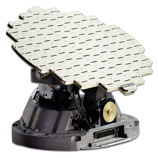
Also, you can examine the angle of the cell’s leading edge to determine direction of movement, monitor the tops of cells to see how quickly a storm is building, and easily distinguish between ground and weather returns. The system is fully stabilized to +/- 30° combined pitch and roll, and antenna stabilization keeps your screen clear of ground returns during moderate aircraft maneuvers. You can choose between two antennas, a 10-inch or 12-inch, to fit a wide variety of airframe applications.
The RDR 2100 uses intuitive colors (green, yellow, red, magenta), and six ranges (10 nm to 320 nm) to depict the weather intensity, creating a clear picture of the weather and making it easy for you to avoid danger. The horizontal scan provides an angle of 120°; the vertical scan an angle of 60°. Using Sensitivity Time Logic, the system can correlate target distance with intensity, and its attenuation compensation reduces shadowing.
The system is fully Electronic Flight Instrument System (EFIS) compatible using ARINC 429 and ARINC 453 databusses. It also features a Multi-Function Display (MFD) interface, fault annunciation, TILT readout on display, and independent dual indicator operation.
In addition to the above features that it shares with the RDR 2000, the RDR 2100 also offers:
- 50% more power, a full 6.0 kW
- 120° view versus 100° view
- 320 nm range versus 240 nm range
- Autorange limiting – alerts you to areas that radar energy cannot penetrate
- Sector scans – allows you to reduce the scan time to concentrate on the area you most want to review
- Auto Step Scan – Auto Step Scan causes the antenna tilt to sequentially step in 4° increments. This allows the pilot to Vertical Profile the entire azimuth scan angle by simply watching successive antenna scans
- Auto tilt – automatically manages tilt angle as the aircraft climbs or descends (with compatible gyro inputs)


Recent Comments